
By Don Schwennesen | Photographs by Carl Davaz
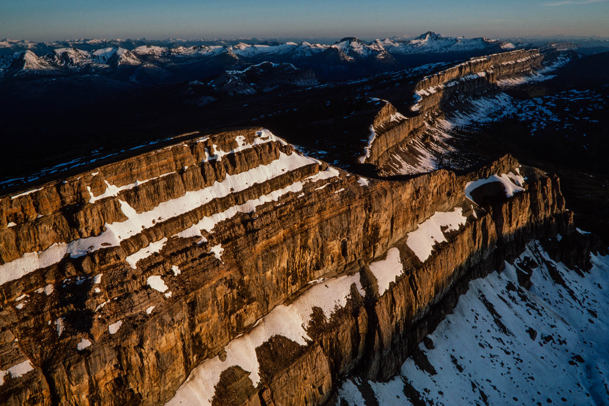
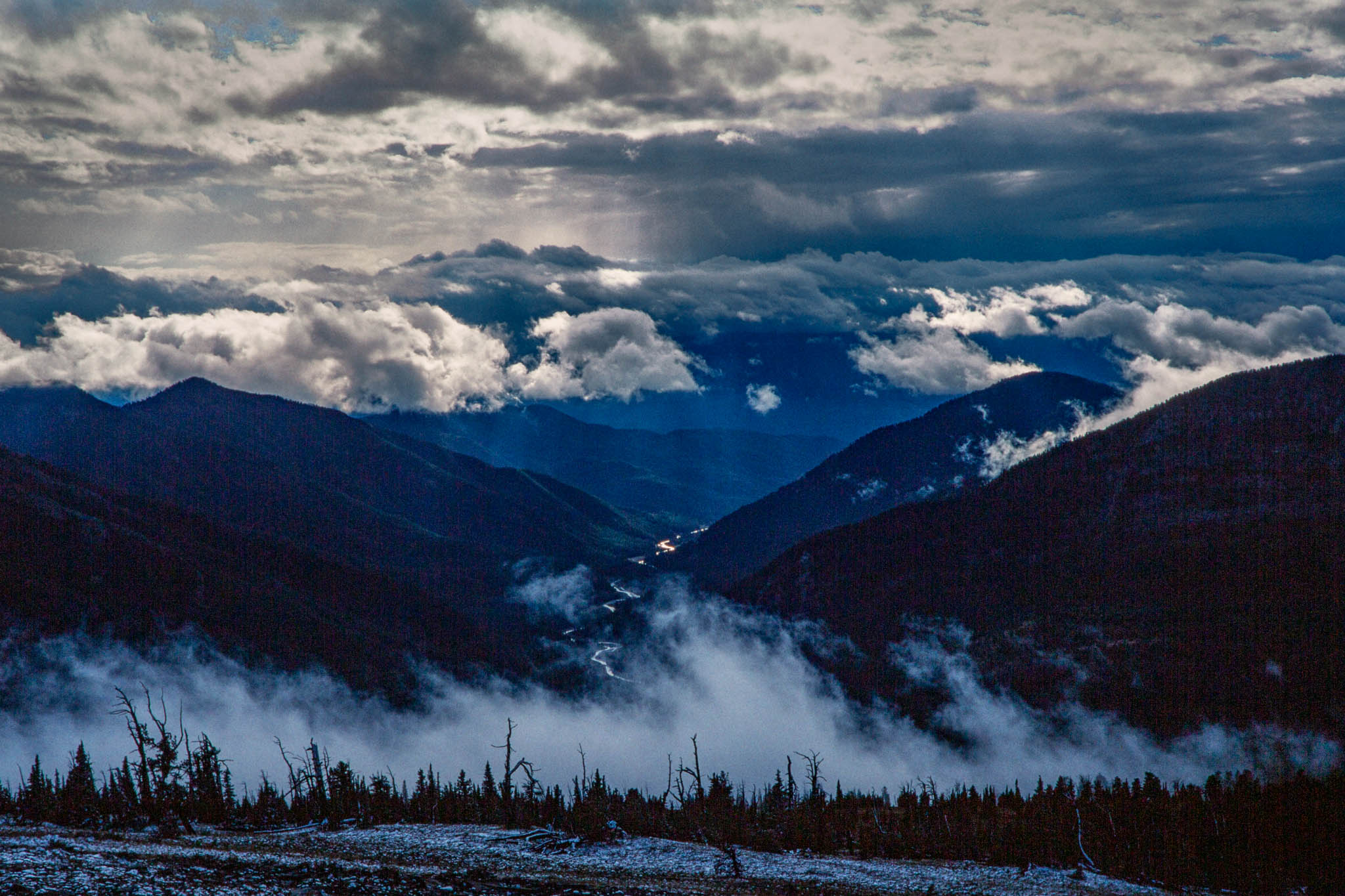
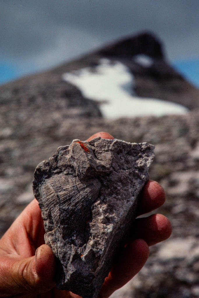
High along the Continental Divide, the Chinese Wall rises like a wave of stone from a wilderness whose grandeur places it among the treasures of the American West. The limestone precipice towers 1,000 feet high and stretches north and south for a dozen miles. The shadowy cliffs form a soaring backdrop for an autumn pageant of rivalry as elk herds gather along the eastern foot of the wall, the bulls bugling and jousting for their harems in the alpine amphitheaters of the Sun River Game Preserve. High above, near the windswept tabletop of 8,539-foot Sphinx Peak, tawny ledges reveal stone impressions of seashells, suspended in time for 300 million years half a continent away from the sea.
To the west, far below in the South Fork valley of the Flathead River, trails wander for days along grassy river flats and wide gravel benches amid great ponderosa pines and Douglas firs that were already old when the pilgrims landed. To wander such a country-through the tall timber thickets, broad meadows, savannah, and silver-gray sage-is to glimpse a vestige of the great western Montana valleys that Meriwether Lewis and William Clark saw when the nation was still new.
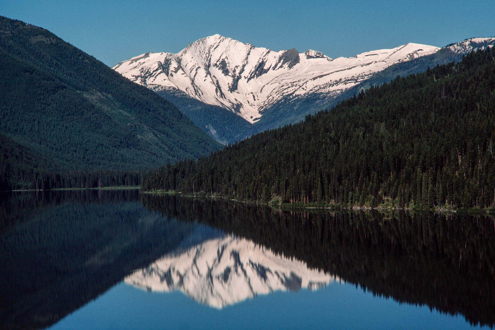
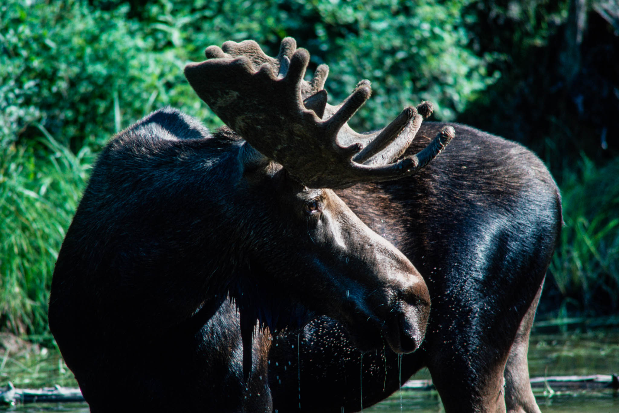
This is the great Bob Marshall Wilderness, more than 1.5 million acres of wild land, a province larger than the state of Delaware. It is probably America’s best-known wilderness, one that has been opened to thousands of visitors by a cadre of professional outfitters and guides who have led expeditions into its recesses for more than six decades. It is a land of goats, moose, lynx, and bighorn sheep, a place where golden eagles sail up out of deep timbered canyons on thermal currents, sweeping unexpectedly through ridge-top passes with the wind singing in their wings. It is a major ecosystem whose diversity ranges from glaciers and barren rocky pinnacles to broad timbered valleys and basin meadows where homesteaders once struggled for subsistence.
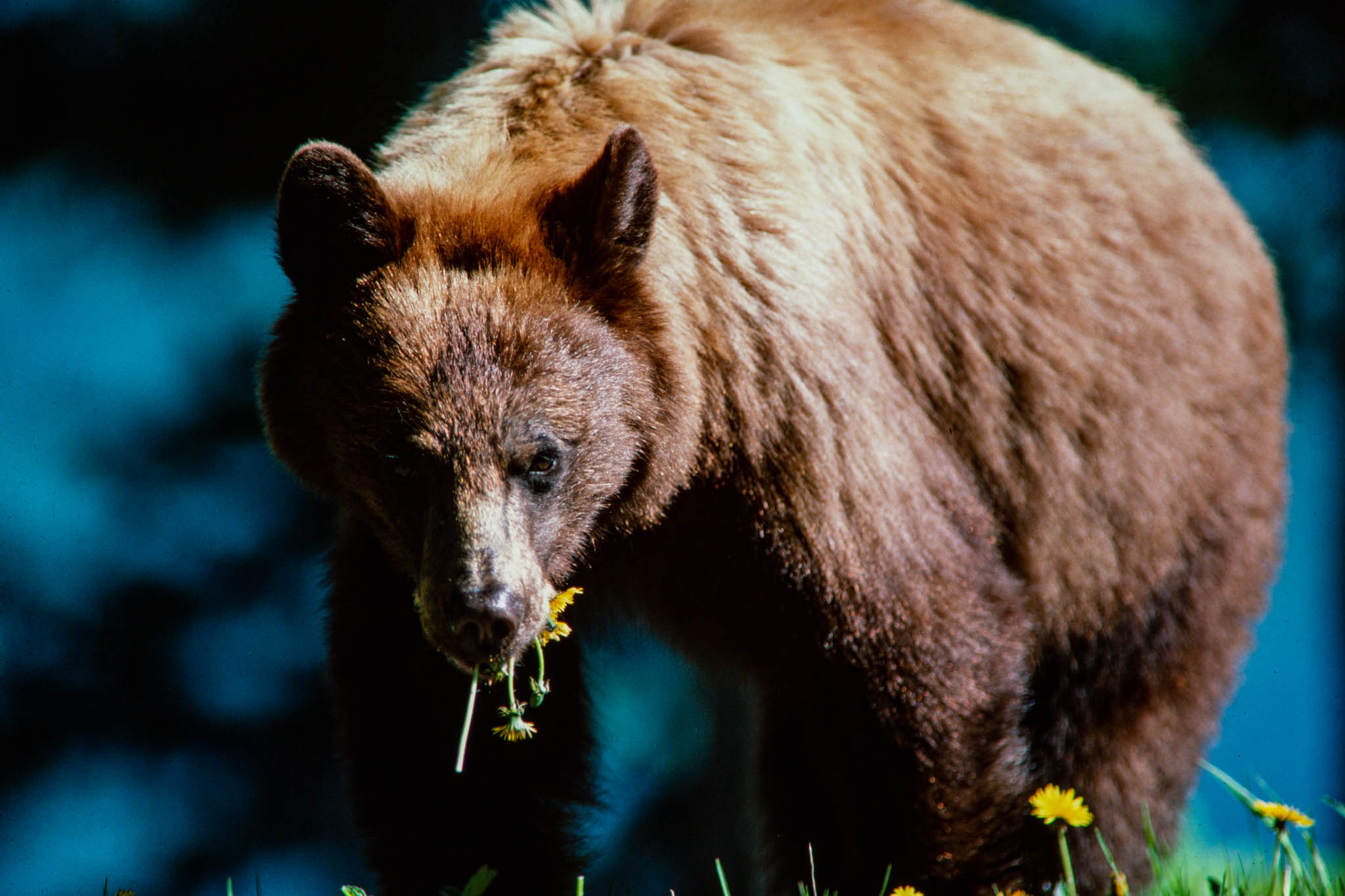
Together with Glacier National Park, it is the last stronghold in the lower 48 states for Ursus arctos horribilis, the mighty grizzly bear, the continent’s most powerful beast and yet a threatened creature so secretive that even veteran wilderness travelers are lucky to glimpse one. It is a land of contrasts and changing moods. For every week of golden alpine sunshine, there is a week of slate sky and chilling rain, when all the world seems morose and senseless visions of the great bear may trouble your dreams. For some people this is a sacred land, a place of power that awakens and humbles the human spirit. It is a land still alive, still growing and changing as the forces of time, weather, and continental uplift mold and sculpt their work.
Today it is three wilderness areas in one, end-to-end, for 100 miles down the Continental Divide. Bounded by the Scapegoat Wilderness to the south and the Great Bear Wilderness to the north, the Bob Marshall is the centerpiece of a wilderness system that encompasses 2,398 square miles. It lends its name to the entire region, which is known to the managers and scientists as the Bob Marshall complex but to the outfitters as the Bob Marshall country, or simply the Bob.
The name honors a pioneering forester, conservationist, and patriarch of the American wilderness movement whose expeditions and writings earned him national renown in his own time. Marshall’s vision helped awaken the U.S. Forest Service to the urgent need for preserving a portion of the vanishing wilderness from which the American heritage had been forged. Before his sudden illness and death in I939, at age 38, he had secured the first protection for nearly 5.5 million acres, including the bulk of the area that was later to bear his name.
Bob Marshall sparked the wilderness dream, but the flame was kindled by the professional outfitters and guides who taught the secrets of the wilderness to their countrymen. Extolled by those who came to know it and popularized in sporting and outdoor magazines, the Bob grew famous for its mountain grandeur, trophy big game, and fighting trout.
Today the outfitter industry is a $30 million-a-year bulwark of Montana’s tourist economy, and the Bob Marshall complex accounts for perhaps $4 million of the total. Yet the industry groans under major stresses. In 2 decades, total use of the Bob has grown at twice the rate of the outfitter industry. Forest Service regulations governing outfitters have tightened, driving up costs. Fewer trips are permitted, fewer guests are allowed per trip, and outfitter fees are increasing sharply. Mean while, other visitors pay no use fees at all, and they enjoy total freedom from regulation. Their impacts are taking a toll on the pristine beauty of the Bob. Most outfitters support high standards for their industry, but a few complain of federal inflexibility and arbitrary interpretation of rules.
About 3,000 visitors a year ride the mountain trails of the Bob or float its wild rivers with outfitters to experience the land and discover its secrets. Shaped by long, north-south mountain ranges and river valleys, the wilderness holds a myriad of wonders: the Flathead Alps, a graceful range of low alpine peaks adorned with high forests and meadows; Big Salmon Lake, 4 miles long and unspoiled by cabins or summer homes; and Needle Falls, where the White River drops into fractured limestone and then boils out of a needle-eyed orifice.
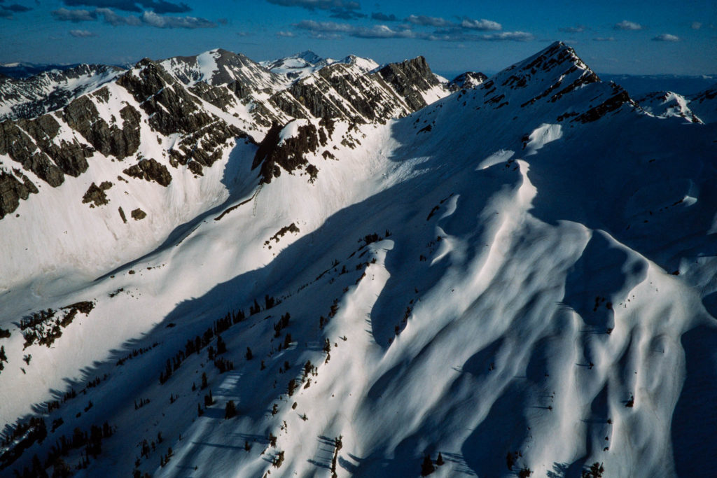
The western wilderness boundary follows the crest of the Swan Range, a rugged mountain front studded by more than a dozen small glaciers and dominated by the summits of 9,356-foot Holland Peak and 9,255-foot Swan Peak. The Continental Divide is the great central rib with the Chinese Wall at its midpoint. Nearly 30 miles south down the Divide, the huge massif of Scapegoat Mountain dominates the wilderness that shares its name. Guarded by cliff walls 1,500 feet high, Scapegoat’s graceful 9,204-foot summit crowns a plateau 3 miles long. At the northern end of the complex, the Flathead Range angles northwest away from the Divide toward 8,705-foot Great Northern Mountain and Glacier National Park, its ridges shaping the northern panhandle of the Great Bear Wilderness.
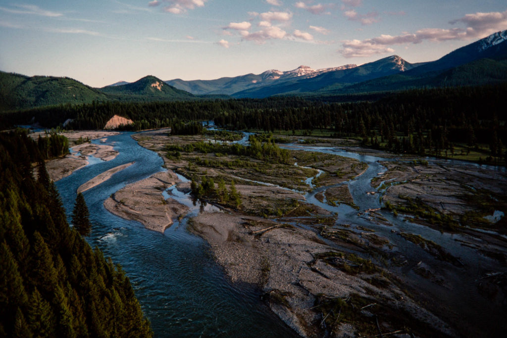
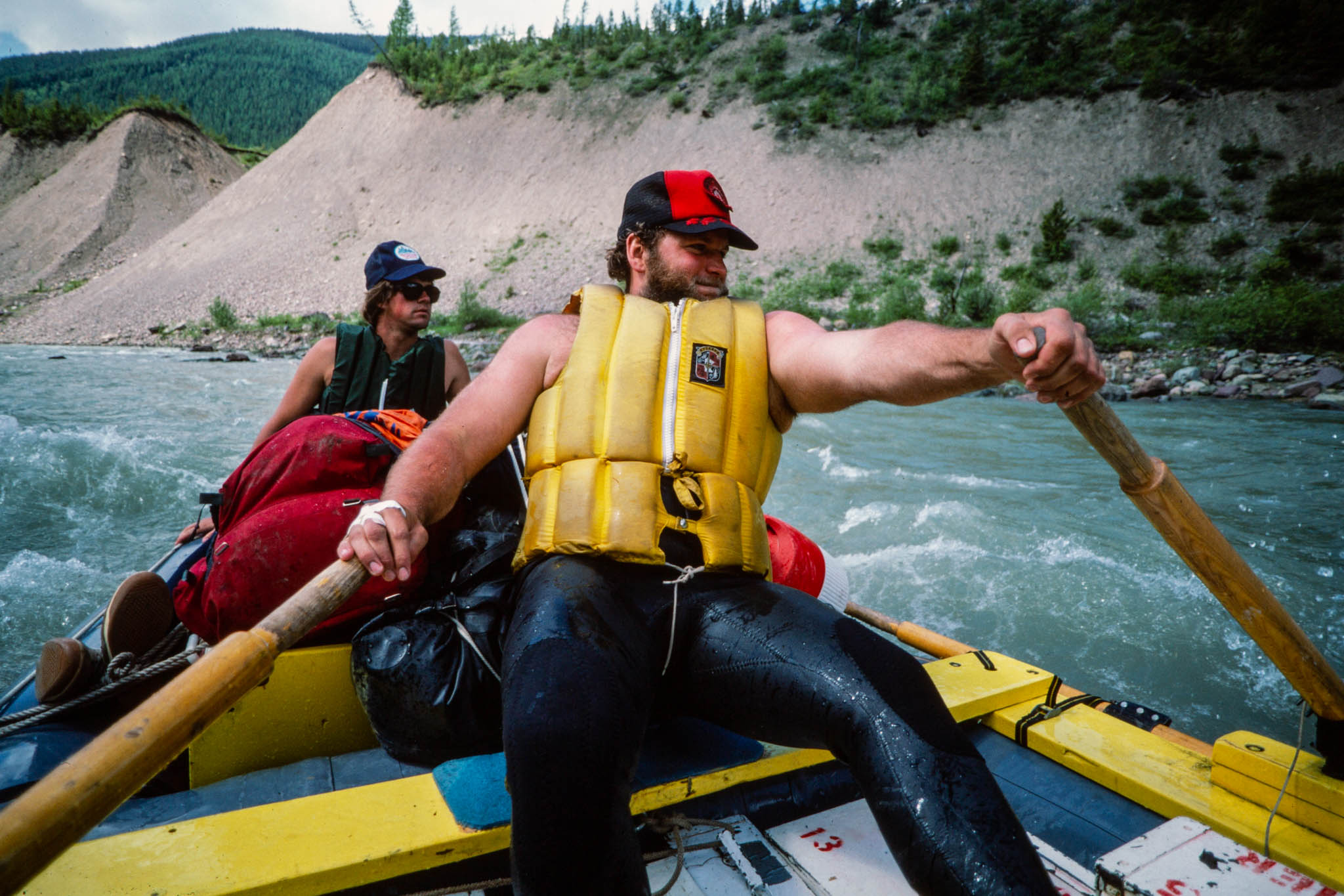
The northern trident formed by the Swan, Flathead, and Continental Divide ranges is drained by two wild rivers: the South and Middle forks of the Flathead. Together with the North Fork adjoining Glacier Park, they form the nation’s longest wild and scenic river system. The wilderness rivers are breeding grounds for the westslope blackspotted cutthroat trout, a genetic relic of the last Ice Age that has evolved to survive in the cold, pure waters of the western Montana Rockies. Scapegoat Mountain is the headwaters for the Dearborn River and for the North and Landers forks of the Blackfoot River. East of the Chinese Wall, the limestone cliffs roll out toward the plains like breakers toward a beach, forming the watershed for the North and South forks of the Sun River. At 9,392 feet, Rocky Mountain, the Bob’s highest summit, dominates the western boundary.
More than 100 lakes dapple the high country, many of them clustered along the Swan Range or scattered across the southern end of the Scapegoat. Cutthroat trout predominate in lakes and rivers, but rainbow have been introduced in a few lakes, as have brown trout in parts of the Scapegoat. Huge Dolly Varden trout migrate up the Flathead to spawn in wilderness tributaries each fall.
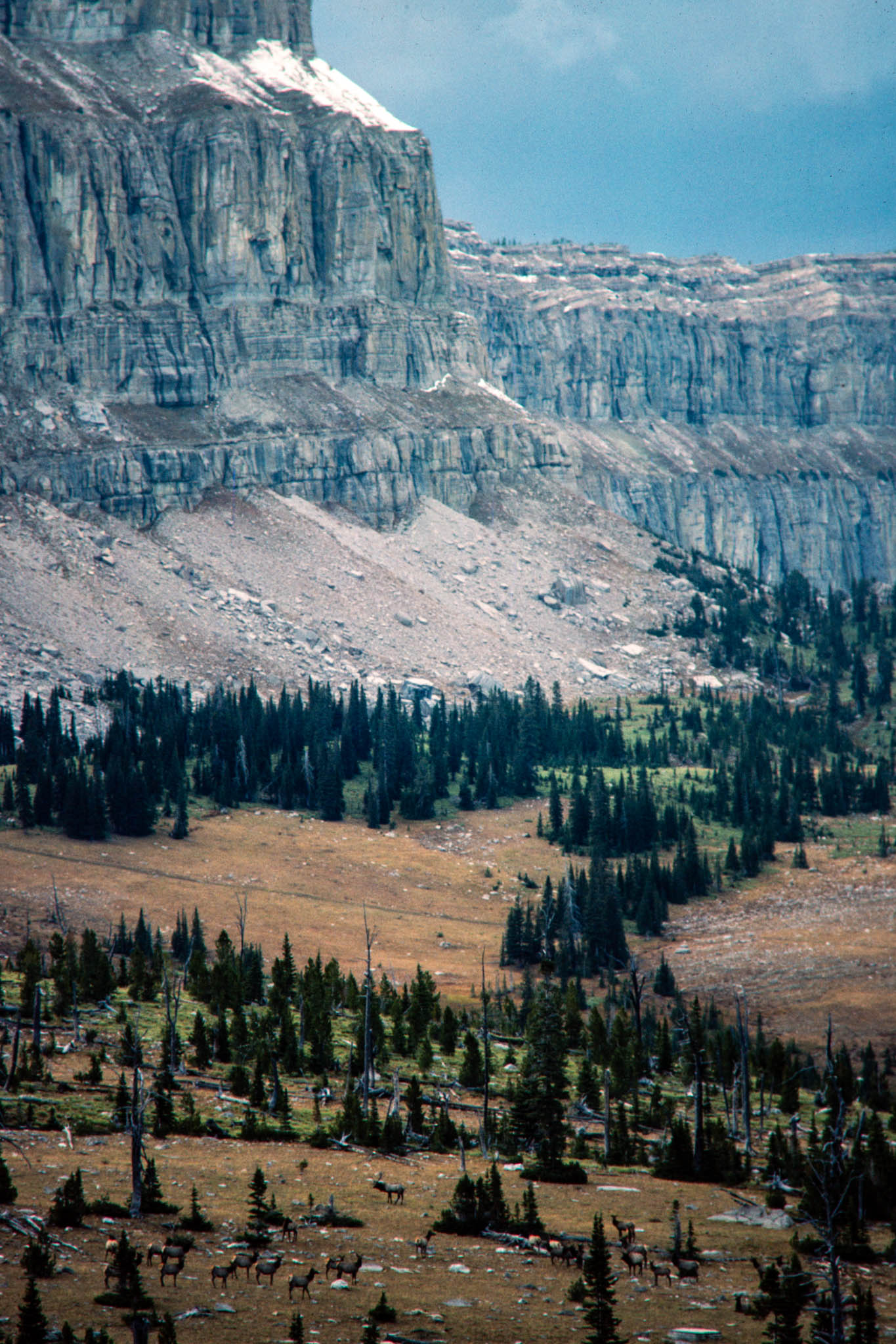
Big game abounds. East of the Chinese Wall, an estimated 2,500 elk roam the sprawling 199,661-acre Sun River Game Preserve. The eastern edge of the preserve supports as many as 1,000 bighorn sheep. An estimated 255 to 335 grizzly bears wander the Bob Marshall ecosystem, the only place in the lower 48 states where grizzly hunting is still allowed. Up to 25 grizzlies may be killed each year, although the quota is rarely reached. Supporters argue that limited hunting culls grizzlies that are less wary of humans and more likely to pose a threat to them. Critics advocate a moratorium as long as the bear is threatened on its other ranges. The Bob has contributed to pioneering grizzly research by Dr. John Craighead, who has used Landsat earth satellite images to identify and map prime grizzly habitat. Even the movements of radio-collared animals can now be tracked by earth satellite.
The Bob lies just east of the Rocky Mountain trench, a zone where some geologists believe two ancient land masses collided a billion years ago. The rocks tell of a prehistoric sea that gradually filled with sediments eroded from ancient continents as life dawned and evolved into shelled mollusks. Perhaps 60 million years ago, at the end of the dinosaur era, the land west of the Bob was uplifted. Ancient purple and green mudstones from the west slid up and over the younger limestones, churning the earth’s crust into chaotic blocks and slabs, pushing them ahead into great jumbled cliffs and walls. It was a collision in glacial slow motion, a few feet a century, one that might still be going on. Where the older mudstones rode up and over the younger limestones, an “overthrust” zone tens of miles wide resulted. Oil and gas seeps in the Bob entice petroleum geologists with the possibility that the younger, buried seabed rocks could yield oil and gas.
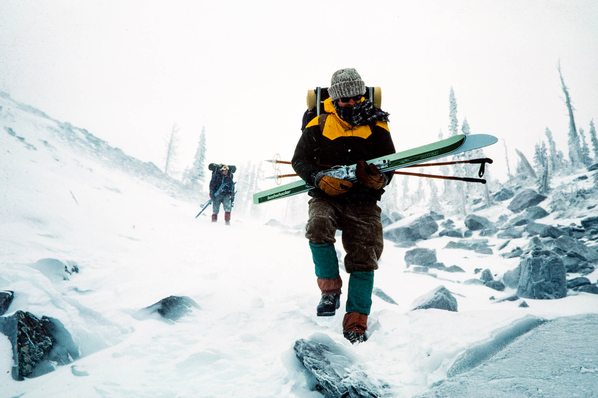
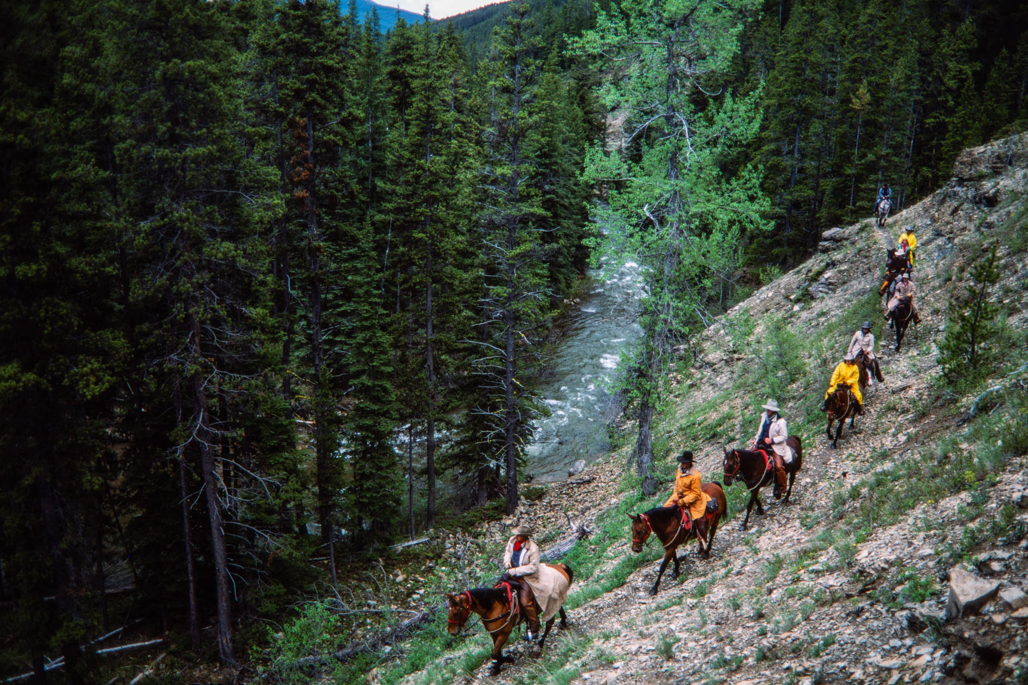
In such vast country it takes days to reach the heart of the wilderness and weeks to search out its soul. From early times, the Bob was horse country because trips required provisions that only pack trains could carry. Yet for all its mountains and distances, it was seldom formidable in summer and fall.
Early foresters built a network of fire trails soon after 1900, when solitary wilderness rangers patrolled ridge tops and watched for fires from lookout platforms built in trees. Today, the South Fork, Middle Fork, and Sun river valleys are major travel corridors, while pack trails wend high along the reef walls or up onto long ridges of grass and alpine timber. The valleys contain few obstacles other than streams, although these can be formidable to cross when swollen by snowmelt in May and June. Few are spanned by bridges. Trails over the major passes can be grueling, but mudholes and poor trail conditions are often more troublesome for hikers than the steep terrain.
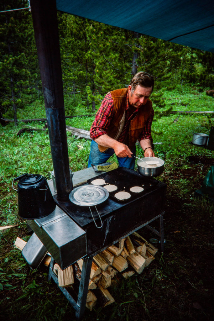
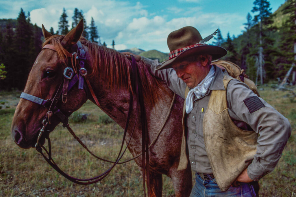
About 60 outfitters lead guests into the three wilderness areas. Known for their rugged independence, outfitters are a remarkable breed of small businessmen who spend summers and falls shuttling supply trains over mountain heights, shepherding guests who may never have ridden a horse, and spinning tales around the camp stove at night. An outfitter and his wranglers often ride 2,000 miles in a single season. A 10-day hunt may cost $1,500 to $2,500 or more for dangerous quarry such as a grizzly. A summer horse or raft trip may run $50 to $100 a day. Some outfitters offer “drop camp” service. For $300 to $1,000, they will pack a hunter and his gear to a likely spot, drop him off for up to 10 days, and then pack him and his game out of the wilderness.
Hunting was the springboard for the outfitter industry as the lure of trophies brought big-game hunters, many of them wealthy executives, politicians, or celebrities. Some came as much for solitude and escape as for hunting. But the clientele has grown to include a diversity of small businessmen, factory workers, farmers, and retirees, some of whom may save up for years for the experience. The outfitters cherish the land and are often in the vanguard of movements to expand the wilderness system. They view their way of life as the passport that opens the wilderness to many Americans who would otherwise never experience it.
“I’ve met a lot of wonderful people from all walks of life, from those who had to save 2 or 3 years to those who could really afford it,” says Art Weikum, who has packed into the White River since 1952. Some find the wilderness overwhelming. “Just the size of it-they can’t comprehend it.” A Pennsylvania congressman once told Weikum he wanted to leave after only 2 days. “He said, ‘I’ve got to get out. The vastness is closing in on me,'” Weikum recalls. “I know what he meant. It’s the same feeling I’ve had a few times in town.”
Even in such vastness, outfitters are competing for elbow room. Today they are far outnumbered by private parties. The growth in use has brought changes, impacts, and conflicts typified by the decade-long controversy over “caches.”
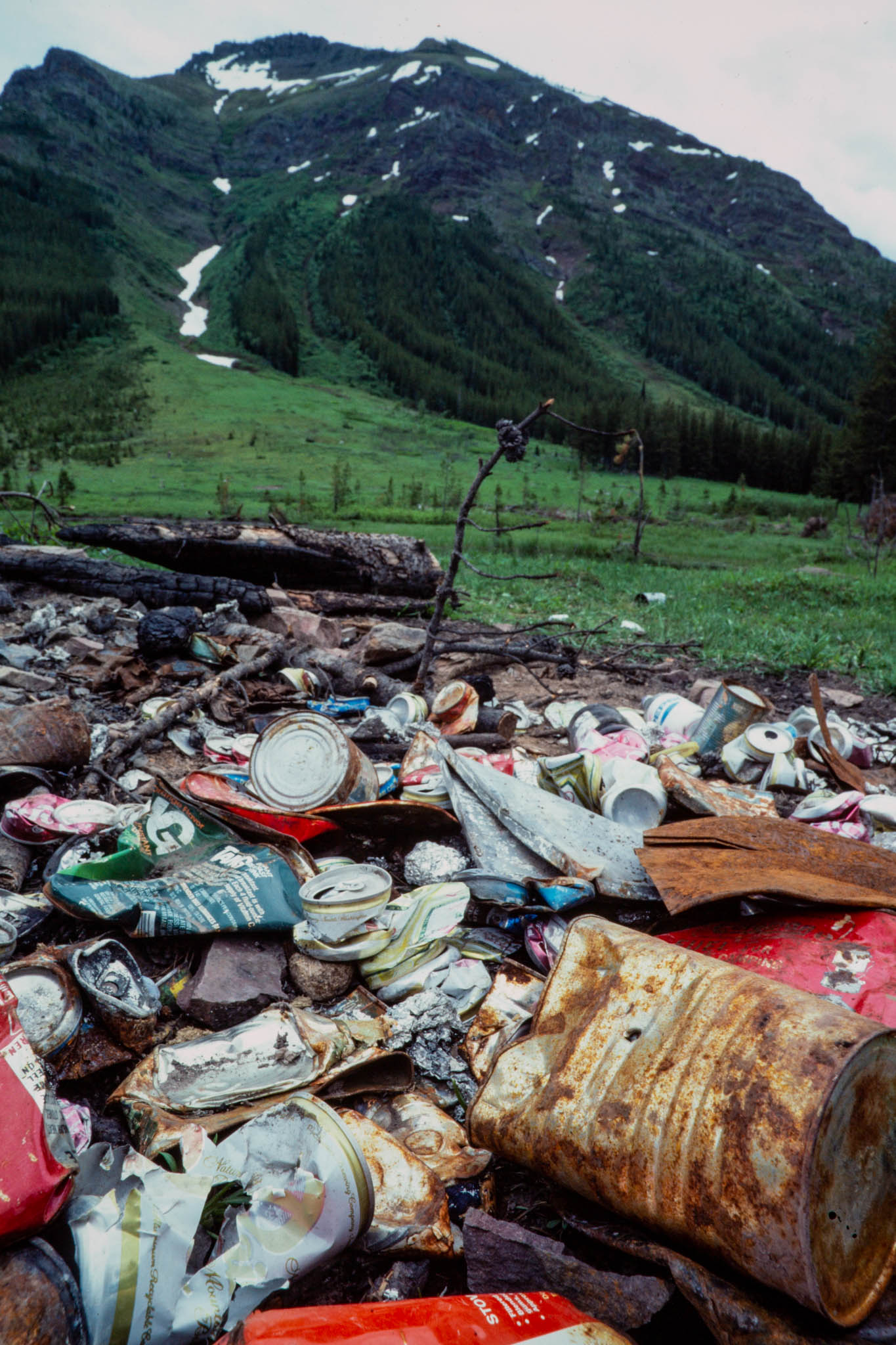
Early outfitter camps were often luxurious to excess, with visitors treated to private tent cabins, beds, carpeted floors, bathing or shower facilities, and sumptuous meals complete with china and wine glasses. Even today, the lavish food served up to weary hunters or riders is a hallmark of wilderness travel. Opulence was in keeping with an age when grand hotels were rising in the national parks and the prevailing philosophy held that visitors should be able to discover their wild heritage in absolute comfort. But it led to the use of caches-small structures where heavy stoves or other equipment could be stored. Log tent frames were left in place year-round, as were corrals, outhouses, and hitching rails. Some camps took on the appearance of permanent settlements deep in a land that was supposed to be untouched by human development. As criticism mounted and the Forest Service pressed for cleanup, outfitters split over the use of caches. Some relinquished them willingly. Others argued that they were insignificant compared to the network of Forest Service cabins, ranger stations, and phone lines still in place from the pre-wilderness period. Caches reduced the number of pack train trips required to haul equipment over trails that the Forest Service was already hard-pressed to maintain. Some saw the elimination of caches as Forest Service retaliation for outfitter support of wilderness laws that in effect took away Forest Service management prerogatives and ordered the agency to protect wilderness. “They were going to ram it down our throats,” one outfitter says.
Today, caches are largely gone. Tent frames are taken down when not in use. Sacrifices in comfort have been minimal. Camps are smaller and more congenial. Modern technology has replaced the bulky trappings of luxury with comparable equipment that is lighter and more efficient.

Outfitter Arnold “Smoke” Elser, who has spent 25 seasons in the Scapegoat, has earned a reputation as a leader in developing better methods. His camp is compact. His single hunting tent is divided into three sections: guests bunk at one end and hired hands at the other, and the kitchen occupies the middle. His entire summer kitchen folds into a compact box. Portable corrals hold stock. A collapsible kitchen stove he designed contains a water jacket to heat water more efficiently.
An advocate of no-trace camping, Elser tells his guests about a friendly game he plays with outfitter Jack Hooker. They pretend they are outlaws fleeing from the sheriff. Though each knows where the other is going, each tries to keep the other from discovering exactly where he has been. That means all litter is scrupulously picked up, horse manure is kicked around and scattered, woodcutting is forbidden in camp, and the sod is removed before any campfires and carefully replanted afterward. If one finds evidence of the other’s passing, the other gets a razzing at their next encounter. Elser believes wilderness impacts would all but disappear if everyone shared his outlaw fantasy.
Intent on reducing impacts, Forest Service managers have steadily tightened the reins on outfitters. Party sizes have been reduced. Where 35 guests were once common, now 10 is a large party and 15 is maximum. Total trips per outfitter have been limited. Fees are slated to increase from 25 cents a visitor-day to 3 percent of the guest’s gross fee. Outfitters are required to file itineraries months in advance and to pack in hay and feed for livestock. Camps are under close scrutiny, each regulated under a camp operating plan approved by the Forest Service. No new outfitter permits are being issued. Though most outfitters maintain high standards, occasionally one will cause a glaring problem. An outfitter camp abandoned in the Great Bear in late 1982 was a startling eyesore the next spring. Outfitters face loss of their permits for failure to clean up camps and meet deadlines. Yet some complain of arbitrary decisions that seem needlessly harsh. One outfitter’s permit was revoked because he was 4 days late meeting a deadline for camp changes that he had appealed. An appeal can take months in the federal bureaucracy, and court action is not allowed until the federal appeal process is completed. Most outfitters believe high standards are essential to protect the wilderness, but many feel they have been singled out by a Forest Service that is politically nervous about attacking the real problem: the backcountry impacts of an unregulated public.
Travel statistics show the visitor trends. In 1960, only about 3,500 persons visited the Bob Marshall. Half came in summer and half during the hunting season. One-third traveled with outfitters. Fewer than 5 percent were backpackers. By 198 I, an estimated 8,000 visitors and 12,000 horses and pack animals entered the Bob on only 8 of its major trails. Total visitors were probably at least double that number. Only 17 percent traveled with outfitters. More than one-third of the visitors were hikers. A startling 73 percent of all visitors were not affiliated with any organized conservation or user group.
Simply gathering statistics on wilderness use is difficult. Only one visitor in five bothers to fill out a voluntary trip registration card provided at wilderness entry portals. To get better visitor counts, wilderness management expert Bob Lucas of the Missoula Forestry Sciences Laboratory set up automatic cameras near major entrance points.
With unaffiliated users now in the vast majority, rangers are hard-pressed to contact visitors and teach the new ethic of no-trace camping. Traditional meetings with organized outfitters, sportsmen, horsemen, and wilderness groups no longer include most users. Mean while, the marks of overuse and carelessness increase along popular routes. Heavier use also means more wear and tear on trails, especially in wet seasons. Trails in wet areas degenerate into mudholes and grow ever wider as travelers detour around them, especially where trails were built on terrain unsuitable for heavy use. Money for relocating them is scarce. A wet summer such as 1983 aggravates the problem.
“We spent an extra $10,000 on the Holland Trail” in 1983, says retired wilderness ranger Cal Tassinari, “but I defy you to show me where that money was spent.” He says many trails cannot take the punishment of heavy horse traffic coupled with wet weather. Increasing use in early spring compounds the damage.
“I go along with this ecology thing,” says outfitter Jack Hooker, who has packed into the Bob for 30 years. “You get very religious about this country after you’ve operated in here so many years. It really hurts me to see private parties set up here and leave a big goddamn mess. I clean up after all these guys. You can’t help but be a little jealous about this country.”
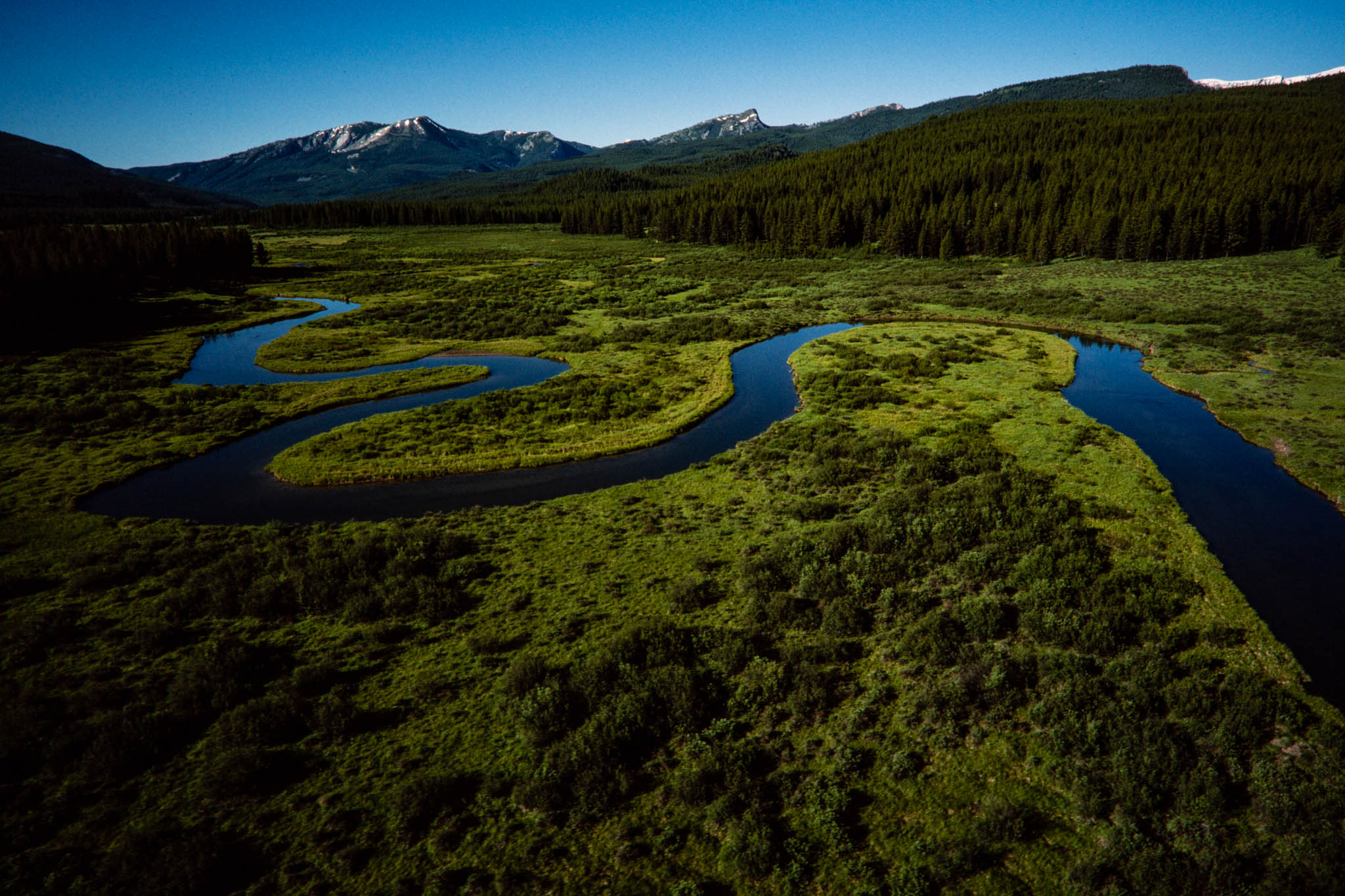


Hooker guides hunters along the southwestern boundary between the Bob and Scapegoat from a camp in the Danaher Basin where Danaher Creek, a tributary of the South Fork, meanders across a luxuriant mountain meadow. But he is worried about the growth in visitor pressure. “Now we’re seeing hordes of private parties,” he says. In 1983, the first week of hunting season found 11 hunting camps set up along the Danaher. Hooker says he does not mind private parties, but they should be limited, to protect the hunting quality for everyone.
“I don’t think it’s fair to over-regulate outfitters when you’re not regulating anybody else,” adds outfitter Ron Curtiss. He believes restrictive rules directed at outfitters discriminate indirectly against their clients, citizens who live far away from the wilderness and are least able to enjoy it on their own.
“They should stop looking at this as outfitters versus the public,” he argues. “This is the outfitted public versus the non-outfitted public.” Illegal “rogue” outfitters also compete with licensed ones, bringing in guests who are passed off as personal friends. Rogue operations are tough to crack, according to Bill Maloit, state supervisor of outfitting, who has patrolled the Bob for 36 years. Undercover agents pose as clients to expose such operations. The state won 18 convictions in 1983 alone. Still, Maloit says the typical fine is $300, “a very minimal business expense,” and the rogue becomes more wary after he is caught.
Administrative changes that create new wilderness attractions also bring additional users. Deep in the Great Bear at the Schafer Ranger Station, a grass airstrip offers the only public air access to the wilderness for commercial pilots, outfitters, river-runners, or private parties who feel like dropping in for an afternoon wilderness picnic. The rasping drone of aircraft fills the Middle Fork canyon at regular intervals as light planes burst over the crest of the Flathead Range and shuttle in with their cargoes of rafts, supplies, and visitors. Other airstrips provide access just outside the wilderness at Benchmark and Spotted Bear. The thrill of soaring high over the wilderness can be an annoyance to those far below trying to escape civilization.
The Schafer airstrip was a fixture long before Congress officially designated the Great Bear Wilderness in 1978. It jumped in popularity after 1976, when the Middle Fork officially became a wild river. The law creating the Great Bear specifically allowed the airstrip to remain open, a provision that did little to quell opposition to wilderness from organized pilots. The law also stipulated that air traffic at Schafer should remain at 1978 levels. That provision leaves managers in a no-win situation. Soon they will be forced to limit air traffic and face the wrath of those who get turned away.
Confronted by these and other problems, foresters are rethinking traditional approaches to wilderness management. The challenge is to develop innovative ways to manage the people who visit the Bob without tampering with the wilderness or inhibiting the wilderness experience. Rejecting the idea of permit systems, with their arbitrary quotas, burdensome reservations, and travel schedules, managers have decided instead to develop methods for measuring the subtle changes that add up to impacts. They hope to define the “limits of acceptable change”-the thresholds at which problems become public nuisances that interfere with the wilderness experience. Led by Jerry Stokes of the Flathead National Forest, a task force representing a broad cross section of wilderness users has spent more than two years defining limits and ways to measure them. If it works, the new approach may make it easier to educate wilderness users about impacts and to decide when field rangers should temporarily close specific sites and ask visitors to give them a rest.
Most problem visitors are not aware that they are causing damage, says Gordon Ash, seasonal ranger at the old Big Prairie wilderness ranger station-now a work center for trail crews. Ash prefers to explain low-impact techniques rather than write tickets.
Some wilderness trends affect outfitters in subtle ways. Decades of forest fire control have resulted in a loss of elk range, new forests having taken over old burns. Between 1889 and 1934, more than one-third of the Bob burned in major fires that created transitional elk ranges of brush and undergrowth while new trees were sprouting. Elk herds thrived, helping to build the Bob’s reputation as a big-game paradise. By the early 1930s, they had outstripped their relatively small wintering areas along the valley bottoms. Massive winter kills followed, with as many as 500 dead elk counted in a single 10-mile stretch along the South Fork after the hard winter of 1933.
“When I first came into this country, there was more elk than I ever saw before,” Hooker says. Numbers declined greatly by the late 1950s, but he believes the elk are increasing again. To help restore the natural cycle of wilderness fire, managers have developed fire plans based on research from the Selway-Bitterroot Wilderness. If fires start naturally under favorable conditions in areas that could benefit from fire, they will be allowed to burn.
Outfitters and conservationists, once at odds over wilderness purity, have become allies recently in an effort to protect the wilderness. Both have helped build a national constituency to defend the Bob against outside exploitation. The first major battle was waged 30 years ago over Forest Service plans to develop roads through what is now the Great Bear. “We had 6,000 names on petitions against that,” says 70-year-old Dallas Eklund of Kalispell, recalling the “Battle of Bunker Creek.”
Until a decade ago, early planning was underway for a major dam at Spruce Park, on the Middle Fork. The plan included a reservoir in what is now the Great Bear, with a tunnel beneath the Flathead Range to divert water to Hungry Horse Reservoir. In 1976, the dam proposal died when the Middle Fork won protection as a wild river.
Outfitters and wilderness groups joined forces to seek preservation for the Scapegoat Wilderness when roads and timber sales were mapped out in the late 1960s. The decision to fight for a wilderness was made at the ranch of the late outfitter “Hobnail” Tom Edwards. A major trail into the Scapegoat today bears Edwards’ name.
Even after an area becomes wilderness, outfitters and others often must continue the fight to guard it from change. One plan advanced a decade ago would have caused watershed changes that some believed would harm wildlife and shorten visitor seasons. Water from the wilderness passes through 16 dams en route down the Columbia River to the sea. During a 1973 drought, the Bonneville Power Administration proposed cloudseeding to increase the wilderness snowpack and augment the regional water supply. At the time, the agency estimated that a10 percent increase in the Bob’s snowpack would yield electricity for 15,000 homes. The plan died when the drought suddenly ended.
The most recent confrontation was a classic environmental battle over the threatened “bombing of the Bob.” The promise of oil and gas from the overthrust touched off a wave of exploration and speculation in the late 1970s, culminating in a 1980 request by a Denver firm to plant explosive charges along 207 miles of seismic lines crisscrossing the wilderness. The idea was to generate underground shock waves that could be plotted electronically to locate possible oil and gas reserves. The request triggered a storm of protest, resulting in thousands of letters and a march on the regional forester’s office in Missoula. Opponents cited estimates indicating that at best the wilderness would yield only enough energy to fuel the nation’s needs for a few days. To marshal opposition, some outfitters alerted former clients through newsletters, while others contacted former guests in high corporate and government places who could carry messages of concern directly to the administration and Congress. In the end, Regional Forester Tom Coston, backed by Forest Service Chief Max Peterson, rejected the application.
With both a far-reaching constituency and an economic importance to Montana, the Bob is one of the most secure American wilderness areas. Yet its recent history shows that it is not immune to outside pressures. The American experiment in wilderness preservation, un precedented in human history and scarcely one generation old, may not survive the test of time and the ambitions of men. If it does, a large part of the credit will go to the hardy breed of modern mountain men who have staked their careers on it in order to bring it to life for others.
Don Schwennesen covered northwestern Montana regional news and outdoor issues through the 1990s for the Missoulian. He became editor and manager of the weekly Bigfork Eagle in 1998, after it was acquired by Lee Enterprises, the Missoulian’s parent company. He retired in 1999 and celebrated the end of the millennium on a six-month camping trek around Australia and New Zealand with his wife, Rose. Upon return, he joined as an active partner in his wife’s real estate business, re-starting a second career that began when he was first licensed in 1972. He continued to advocate for conservation and land-use planning, serving in leadership roles with Citizens for a Better Flathead, a local advocacy group. He and Rose also found time for travel, including annual extended backpack trips into Glacier National Park and the Bob Marshall Wilderness. They celebrated their 50th wedding anniversary in 2019, and they remain active in real estate, while supporting a variety of land-use and conservation causes. Their small orchard-vineyard still produces organic sweet cherries and grapes at the homestead overlooking Flathead Lake, and their passions range from travel, camping and wilderness hiking, to international folk dancing, geology/rockhounding — and of course grandchildren.
Carl Davaz became director of photography at the Missoulian in 1979, where 44,000 square miles of rugged western Montana made up the newspaper’s coverage area.
His partnership with reporters Steve Woodruff and Don Schwennesen underscored a commitment of words-and-pictures storytelling. Their newspaper project to explore elements of the often-contentious wilderness designation and management process became the book “Montana Widerness: Discovering the Heritage,” which Davaz photographed and designed.
In 1986, Davaz left Missoula for Eugene, Oregon, and The Register-Guard to become the family-owned newspaper’s director of graphics. Davaz and his Register-Guard staff were recognized as a 1999 Finalist for the Spot News Photography Pulitzer Prize for coverage of the Thurston High School shootings in 1998.
He retired in 2018 as deputy managing editor after working at The Register-Guard for 33 years. He remains active in photojournalism, publishing technology and book design. In 2022 he was honored by the Kansas Press Association as an inaugural member of the Kansas Photojournalism Hall of Fame.